

The Eyre Peninsula forms the eastern curve of the Great Australia Bight and its southernmost point faces the mayhem of the Southern Ocean. Near Port Lincoln, where flannel-shirted millionaires harvest tuna, lobster and shrimp, Lincoln National Park occupies all of the Jussieu Peninsula and clings tenuously to the mainland while reaching into the Spencer Gulf.
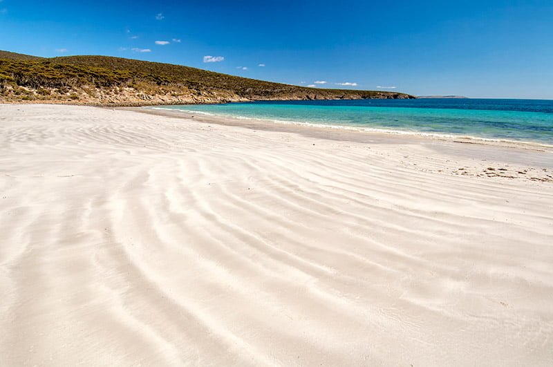
To the west of the Eyre, Coffin Bay Peninsula forms its own national park, also kicking into the ocean with surf-ravaged beaches to the south and bayside coves to the north. For the RVer, Lincoln NP and Coffin Bay NP offer unparalleled exploring, though highlights along the way are plentiful.
DIVING WITH CUTTLEFISH
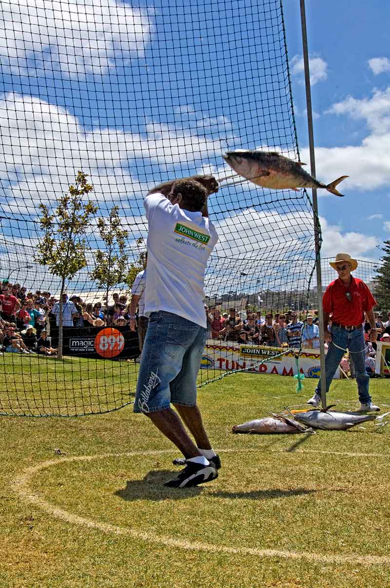
From Port Augusta, head south along the Lincoln Highway to Whyalla. If you are a SCUBA or skin diver and in the area between May and August, don’t miss a dive with the Australian giant cuttlefish during the world-renowned Whyalla Aggregation.
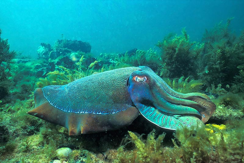
You can snorkel with the cuttlefish on your own off of Black Point or join a dive tour in False Bay. There are two RV parks and also cheap and free camping along the foreshore of Point Lowly and Fitzgerald Bay. It truly is an experience you will never forget.
The 270km drive south offers a number of seaside villages; however, basing yourself in Port Lincoln makes the most sense for exploring the Eyre’s southern tip. There are several caravan parks to choose from, a few of them by the water (if you are under canvas, expect plenty of wind).
The Visitor Information Centre is at 3 Adelaide Place (phone 1300 788 378). It can provide advice on everything you will need (including diving with great white sharks – just think of that story at beer-o’clock).
LINCOLN NP
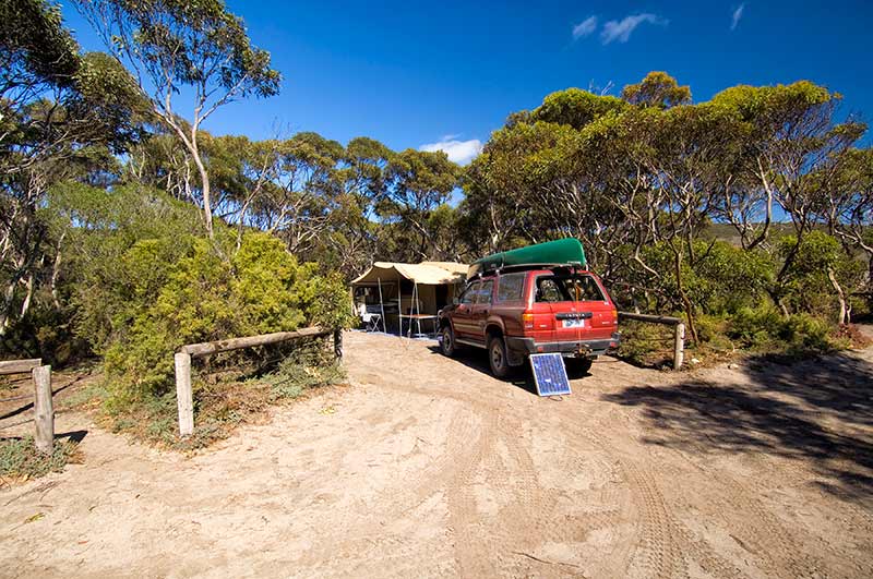
Exploring Lincoln NP is a must. If you have a tent or camper trailer, the Memory Cove Campground offers peaceful solitude. To visit, first stop at the information centre for up-to-date details.
Memory Cove is accessed by an unsealed track suitable for 4WDs or AWDs; collect a key to enter the Wilderness Area. There are only five small campsites there, which must be booked in advance and if time and the weather allow, it is a nice spot for a night or two.
Also, pick up the self-guided drive brochure and any other information available on Lincoln NP.
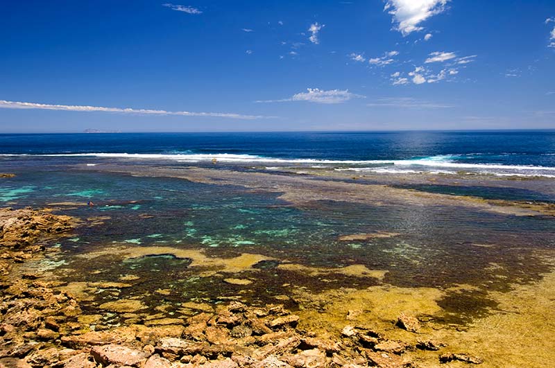
The self-guided brochure corresponds to a number of posts pointing out flora, fauna and historical facts. At 26km is a short track with a turnaround to the Jussieu Bay and Curta Rocks lookout; use binoculars to watch seabirds and marine mammals around the rocky isles below.
There is another track to a lookout (with parking and a turnaround) at 33km; from here, an old driving track is now a three-hour return hike to the West Point cliffs. This hike is best done from a base camp at Memory Cove.
The Williams Island lookout track is at 37km; on a clear day you can see Williams and a number of other offshore islands.
The Cape Catastrophe Lookout is at 38km and the Memory Cove day-use area and campground is at 42km. Be sure to take the beach walking track to the memorial tablet erected by Mathew Flinders in 1802. This pays tribute to eight of his crew members who drowned when their cutty capsized in a search for fresh water ordered by Flinders.
Flinders was devastated by the event and gave Cape Catastrophe its name; he also named eight offshore islands for the men who perished there.
About 30m to the right is a rocky outcrop used by whalers as a note board to leave messages for other boats. After a good look around or a night of camping, backtrack for 34km and turn right to Cape Donington.
EYRE PENINSULA’S CAPE DONINGTON
The unsealed road to Cape Donington is easy; the highlights are pretty beaches along the northern shores and cliffs standing guard over the eastern coast. Numerous walking tracks branch in all directions. A number of campgrounds, some with facilities and some without, dot the shoreline.
At 10km from the turn-off is a 7km road on the right heading to Taylors Landing with a campground, a boat ramp and views out to those same islands named by Flinders. Watch for migrating southern right whales from June to October.
At 12km is a 6km road on the left to Surfleet Cove and a campground near the water. A 4WD-only track follows at 14km with a left to the inner shores of Spalding Cove, and at 15km is another 4WD track on the right to MacLaren Point with secluded bush camping. Stop for a look at Fishermans Point at 19km followed by a 4WD track on the right to Carcase Rock with yet more bush camping.
September Beach, with a campground, is on the right; a track on the left leads to Donington Cottage, the old lighthouse keeper’s lodge that is now available to rent.
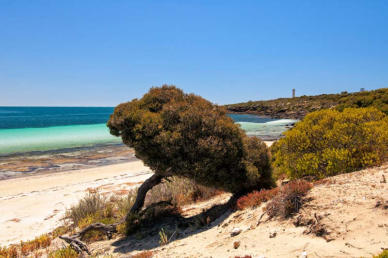
Cape Donington itself is at 24km, rising at the north-east tip of the park with a lighthouse that still serves to guide ships making their way through a network of islands and reefs into the Spencer Gulf. A coastal bush camp is to the left.
WHALER’S WAY
Another drive from Port Lincoln on the Eyre Peninsula is Whaler’s Way via the village of Sleaford. Dramatic coastal scenery with breathtaking lookouts are the name of the game. Pick up a permit and key from the information centre and count on at least a couple of hours to cover the 14km route.
After stocking up on all supplies in Port Lincoln and visiting the information centre again for brochures and advice on Coffin Bay NP, head west on the Flinders Highway where parts of Coffin Bay will present far more of a 4WD challenge than Lincoln does.
Pick up a tide table at the Beachcomber Deli and plan the drive to Gunyah Beach on a low tide. The drive to the western end of the park involves traversing Seven Mile Beach up and back. Time these for about three hours either side of a low tide, giving you about six hours to explore the north-west end of the park (or you can camp for a night or more).
The south-east end of the park can take up a half to a full day, depending on if you attempt the dune drive out to Gunyah Beach. If you are towing, set up camp at the Coffin Bay Caravan Park or at Yangie Bay and leave that RV behind. The Gunyah Beach turn-off is on the left at 9km beyond the entrance to the park. Pull off the sealed road and stop to engage 4WD and to drop your tyre pressure for sand-dune driving.
Tall wooden poles painted red at the top mark the track; stay between these for the 4km to the beach. You may drive along the beach for 3km to the east or west of this point, beyond that is a protection zone for seabirds. Note that the sand is soft; vehicles frequently become bogged. Exit the beach from the same point where you entered, backtrack to the main road and turn left.
Less experienced 4WDers do just as well a few kilometres past the Gunyah turn-off with the Templetonia Lookout on the right. A walking track leads to views of Kellidie Bay, Mount Dutton Bay and Yangie Bay to the north. At 5km is a T-junction; turn left on the sealed road.
A 4WD track to a boat ramp enters on the right, then the Golden Island Lookout and car park is at 11km. This affords superb views of the Whidbey Isles Conservation Park and of the marine life swimming below. A walking track provides access to Almonta Beach, which has excellent shore fishing. Almonta is simply the western end of Gunyah Beach.
YANGIE BAY
After this short exploration to the south-east, allow a full day to explore the north end of the park. Again, vans may be towed no further than the Yangie Bay Campground. For the less experienced 4WDer or AWDer, this is a perfectly delightful place to spend some time, especially if you want to launch a kayak or do some bush walking or fishing.
If beach and sand driving is in your realm of expertise (tents and offroad camper trailers only), then it is 14km from the entrance to a T-junction, turn right and continue for 1km where the road becomes unsealed.
Stop to engage 4WD and lower your tyre pressure for the sandy, rutted tracks ahead. This is Yangie Bay and a good place to start a kilometre count at zero.
At 2km is a track to bush camping on Yangie Bay and at 3km is Lake Jessie on the right with sand dunes rising to the left.
Lake Damascus follows on the left at 11km and at 13km is a track on the right to the Black Springs Campground. This makes a nice base camp for tents or camper trailers near a sheltered beach and also offers a 1km bush walk to a well and a 6km hike to the Black Rocks Lookout.
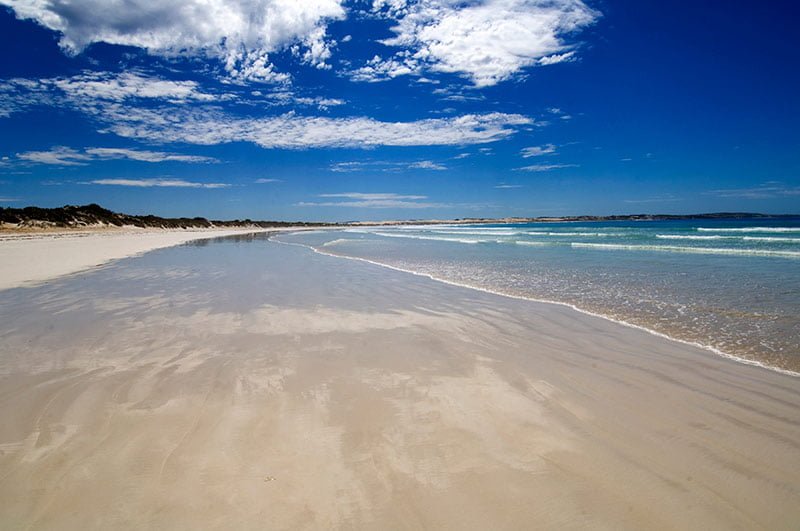
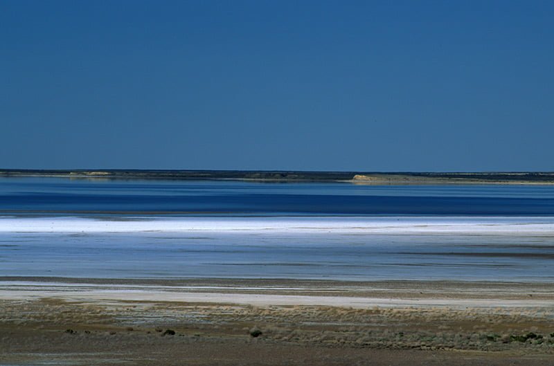
Take it easy around the 19km mark since the track is prone to flooding here. Drive straight through the middle, not along the edges. The track bends to the left at 21km, entering Seven Mile Beach. On a calm day, the water is like a sheet of blue glass with towering dunes of pearl-white sand rising near the shore.
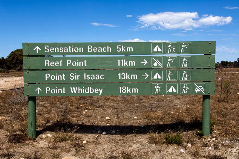 Stay between the high and low tide mark and note that clusters of dried seaweed often indicate soft patches of sand. Be especially careful through the limestone flat at 27km and watch for the track to Sensation Beach entering at 29km; turn left and stay left, following the signs to Sensation Beach.
There are ruins in this area from the old station horse yards, and then the landscape changes to marshland. Watch for oncoming traffic through the dunes; the beach is at 36km and it is indeed sensational. This borders the Whidbey Wilderness Area with a multi-day hike, an information bay and bush camping.
After a bit of a walk on the lonely beach, backtrack for 5km and at 41km turn left to Point Sir Issac. Continue past the Ranger’s Hut then branch left again at 43km to Reef Point Lookout which will be at 51km.
A walking track leads down to a beach with a network of protected rock pools that make for great snorkelling or a reef walk at low tide. Watch for migrating southern right whales from June to October. Reef Point is also a perfect spot for a picnic lunch.
Backtrack for 8km and, at 59km, turn left to Point Sir Issac. A 1km track to Mullalong Lookout and Mullalong Beach enters on the left at 66km; this is worth the short drive, which brings you back to the same point now at 68km.
At 70km, the track forks. It is 1km to Point Sir Issac with a functioning lighthouse and a cove on the right that is a popular playground for dolphins.
Return to the fork (72km) and continue along the coastline. The Pool Campground is at 73km followed by gorgeous Phantom Cove at 75km. The track sweeps inland for a while, stick to it like glue as there is a sinkhole on the right followed by Whalers Well, which is now capped, and then by Burgess Hut built in the 1880s during a failed attempt to tame and graze this harsh land.
Veer left at 81km to Morgans Landing and the campground at the western end of Seven Mile Beach. If you are caught on an incoming high tide, this is a good place to wait it out until you can safely make it back along Seven Mile Beach with 30km of driving to your start at Yangie Bay.
AT THE TIP
The tip of the Eyre Peninsula is all about the scenery and the way wind-ravaged cliffs. Towering dunes face the Southern Ocean while protected bays and coves offer waters as calm as a whisper.
If you are hooked, turn north on the Flinders Highway for one stunning lookout after another. Venus Bay is enchanting; be sure to walk out on the jetty if spending a night in the caravan park (you may find yourself wandering the village in search of beach shacks for sale).
Baird Bay is as delightful, especially if you go out on the Baird Bay Ocean Eco Experience to snorkel with sea lions and dolphins (there is a campground with basic facilities). Streaky Bay is the north-west point of the Eyre, and then comes Ceduna, which is the end, or the beginning, of your adventure to the tip of the Eyre. It is an adventure you won’t soon forget.
– Images: Steven David Miller/Natural Wanders
FAST FACTS
Caution: Gunyah Beach and the north-west section of Coffin Bay National Park are for 4WDers experienced in sand and dune driving with low range, high clearance, recovery gear such as MaxTrax, a warning flag and preferably travelling in a convoy of at least two vehicles.
If this isn’t you, then please stick to the other beautiful spots we have suggested.
ADDITIONAL INFORMATION
Purchase permits and book campsites online or at the Port Lincoln Visitor Information Centre.
- National Parks & Wildlife Service South Australia
- Lincoln National Park
- Coffin Bay National Park
- South Australia Eyre Peninsula brochure (also available at SA information centres).
- Eyre Peninsula Tourism Website


