

Brisbane has to be luckiest city in Australia, with access to some of the best sand islands on the planet, all anchored right off the coastline. Let everyone else flock to Fraser Island while you quietly slip off to Moreton (Mulgumpin) Island. It is smaller, less crowded, and it is enveloped in gorgeous beaches. Promise not to tell anyone else though, because that is exactly how we want to keep it.
If your RV setup is anything other than an offroad camper trailer, leave it on the mainland and go with a tent. Or you can hire a camper trailer on the island (Moreton Island Camper Trailer Hire). Determine what you want out of a campground, and how far you are willing to tow a trailer through sand, and then pick a camping area.
MORETON ISLAND CAMPGROUNDS
All campgrounds and zones, other than the Wrecks, allow camper trailers. For those who are tenting it and don’t need to be adjacent to their vehicle, the Wrecks Campground, where the Micat ferry offloads its passengers on the beach, is perfect.
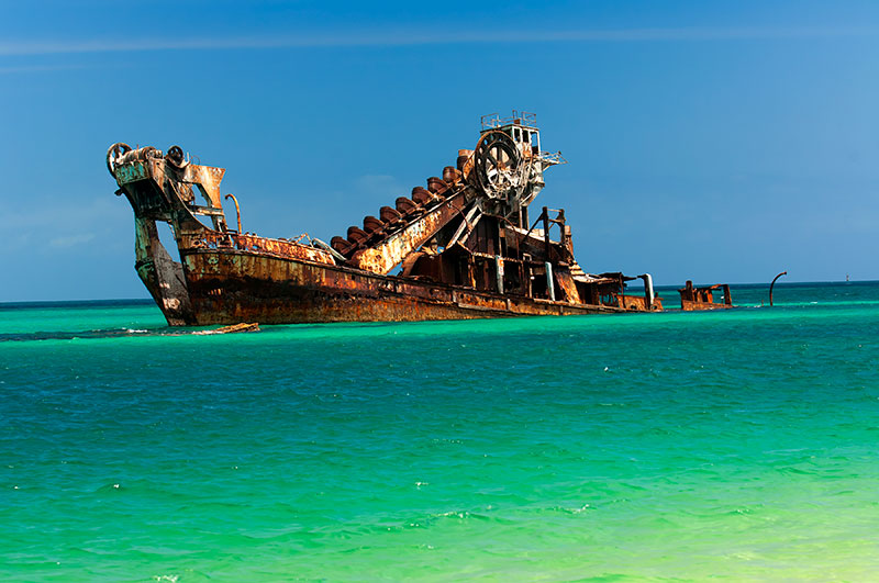
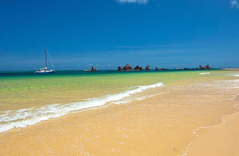
This is closest to the Tangalooma Wrecks, a cluster of rusting barges and dredges sunk there to create safe anchorage and an artificial reef. The snorkelling is good, as is the kayaking and swimming from the beach.
North of the Wrecks Campground (1.4km) is the Ben-Ewa Campground and ranger station. Vehicle-based tent camping is permitted and there are sites for camper trailers. This is an excellent choice, giving you easy access to snorkelling on Tangalooma Wrecks, and to Middle Road leading to the east coast of the island for exploring, 4WDing and hiking.
If you want to camp at the Comboyuro Campground, near Bulwer, camper trailers must be towed up the Cowen Cowen Bypass and then along the beach to Bulwer and then Comboyuro, a drive that must be timed around a low tide. This is also the North-West Zone.
The North Point Campground, 22km from the Micat drop-off, also has camper trailer sites, as does the neighbouring Yellow Patch Zone. Access these via the same route to Bulwer, then use the Bulwer Bypass to access Bulwer-North Point Road. Middle Road is too boggy for towing and no one is going to like you if you get stuck in the sand there.
Moreton Islan’ds Blue Lagoon Campground, 16.5km from the Micat drop-off, has sites for offroad camper trailers; access this via the same route as North Point but continue south on Bulwer-Blue Lagoon Road. Again, Middle Road is not suitable for towing. The North-East Zone also runs along here.
Moreton Island’s South East Zone runs south of Middle Road for about 13km; however, towing is not recommended so this is better for tents.
The South-West Zone, running 17km south of Tangalooma to Toulkerrie, is for experienced drivers only with full-recovery gear, equipped for remote-area travel and communication, and travelling in a convoy of at least three vehicles on a low tide only – you won’t want to continue living if you go there without insect repellent!
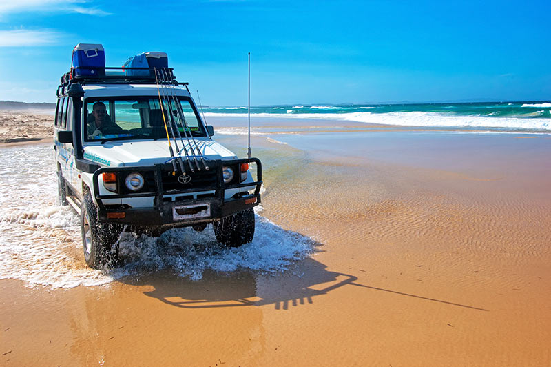
So all the planning is over, and you are finally on the vehicle ferry to Moreton Island’s Tangalooma Wrecks. Take this time to lower the tyre pressures on your vehicle and trailer (locals go with 18psi) and engage 4WD, because the action starts as soon as you land.
Micat sells firewood and sand boards, and there is an air-compressor for inflating those tyres on the trip back to the mainland. Pick up any visitor guides or maps they might have.
Head straight to your campground and after setting up, enjoy a good look around. There is lots to do, but to explore the island you should save one four to six-hour block around low tide to see the north half of the island, and another low-tide block for the south end.
MID-EAST COAST
If you are camping at the Wrecks, Ben-Ewa, Comboyuro or the North-West Zone, a drive to The Desert for a look around and some sand-boarding might be in order. Travel 1.4km east on Middle Road and turn south on the Tangalooma Bypass Track; continue for 3km to a branch in the track, and veer to the left for another 1.5km. The Desert parking area is on a cutback track, then it is a short walk to the dunes.
For any bushwalkers wanting to do the 19.6km (return) Rous Battery Track that emerges at kilometre marker S11 on the east coast, this is the start of that track. For those who prefer a shorter bushwalk, there is a 4km (return) track just south of Tangalooma Resort arching inland to The Desert.
MIDDLE ROAD
Middle Road’s soft, boggy one-way twin tracks cut the island about halfway down running from west to east and back. Take time to enjoy the 7km passage through green foliage, then watch for a 4WD track branching north.
This track runs for 2.5km to the Mount Tempest Lookout parking area with a steep 1km return walk up to the lookout. At 280m above sea level, this is thought to be highest coastal sandhill in the world.
This is also the start of the Telegraph Track, an 8km one-way bushwalk north to a bend in the Bulwer-Blue Lagoon Road. Return to Middle Road the same way and continue east for 0.6km. Suddenly, you will emerge from that green corridor onto Eagers Beach. All beach travel must be timed two hours either side of a low tide, with particular attention paid to estimated travel times.
SOUTH FROM MIDDLE ROAD
The beach drive south runs along the South-East (bush camping) Zone and on to Kooringal. One kilometre south of Middle Road is the first of 10km markers placed every 2km: this starts with S1 and ends with S19 at Mirapool Lagoon.
Mirapool is1km south of the inland 4WD track, cutting over to Kooringal and Reeders Point.
Plan this drive two hours before a low tide to make it to Mirapool near low tide as vehicles are not permitted between a mid and high tide in the lagoon zone. This allows two hours post low tide to make it back up the beach.
Surf fishermen might want to try their luck around S7 on Gonzales Beach, just north of White Rock (S9). S11, Rous Battery featuring the remnants of a WWII fort, marks the end of that walking track beginning at The Desert. An untreated bore water tap can also found here.
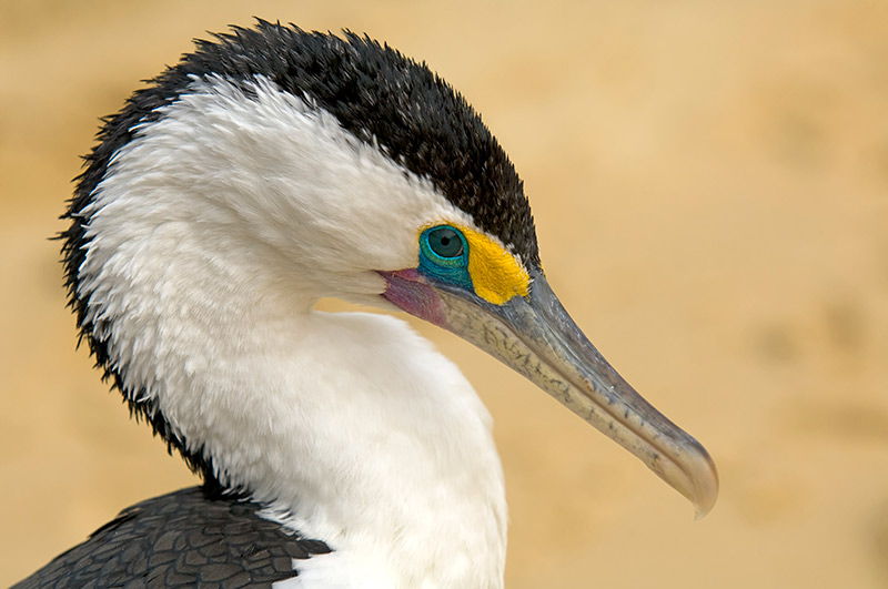
For more of a look around the southern end of Moreton Island, especially if you are waiting to take the vehicle barge to Straddie, you must use the inland track to access Short Point. Birdwatchers may want to take the west coast bypass track to Toulkerrie to watch the numerous wading birds combing the tidal flats at low tide; this is also when a wealth of marine life is exposed.
The Kooringal General Store is a good place to stock up on supplies and The Gutter Bar is known for its Moreton Bay Rock Oysters.
Do not try to return to Tangalooma via the west coast as this is often impassable even on a low tide (this is the South-West Zone mentioned earlier that is for experienced drivers with full recovery gear and communication travelling in a convoy of at least three 4WDs).
NORTH FROM MIDDLE ROAD
Back up to Middle Road is a beach drive adjacent to the North-East (bushcamping) Zone that should be timed about two hours either side of a low tide, allowing plenty of time to explore and continue driving along the beach.
The kilometre markers start 2km from Middle Road: N2 and so on through N14 at Cape Cliff and Braydon Beach. At 1.3km is Eagers Creek, pouring a stream of fresh water through the dunes and across the beach into the sea.
Nearby Eagers Swamp is being invaded by a system of mobile dunes. Stop before the creek crosses Eagers Beach to have a look around, and after evaluating the creek crossing, continue north up the beach. Surf fishermen might want to stop and throw a line in about halfway between N4 and N6.
N6 marks the east end of Bulwer-Blue Lagoon Road. If you are picking someone up who has done the Telegraph Track from Mount Tempest, proceed 5.1km to where the Telegraph Track ends. At the very least, take a quick 1.6km run up this road to find the parking area and a short, easy walk to a lookout over Honeyeater Lake, a perched lake much like Lake McKenzie on Fraser Island. Watch for honeyeaters feeding on the surrounding banksias.
Continuing on Warrajamba Beach for 0.7km is the Blue Lagoon Campground and day-use area with picnic tables and toilets. A short, easy walking track leads to a sandblow beside this window lake edged by a sandy beach. This is a superb spot for some morning tea or a picnic lunch.
Take care on the driving track leading up from the beach to the carpark; you may need to further lower your tyre pressure to get through this. Warrajambe Beach becomes Spitfire Beach nearing N10. Take care here as Spitfire Creek crosses the beach and can create a deep, sharp drop-off. Lake Jabiru is inland and can be seen later on from the Five Hills Lookout.
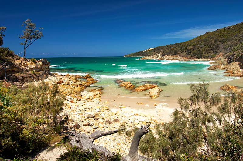
The kilometre markers finish with N14 at the Cape Cliff end of Braydon Beach. This is one of the prettiest, and most protected, spots along the east coast of Moreton. The authorities advise against swimming at these beaches.
CAPE CLIFF TO NORTH POINT
Reluctantly, you’ll leave Braydon Beach on an inland track running up to the Cape Moreton Conservation Park. Make sure a vehicle isn’t coming down the track and use a low gear to run up the series of slats and/or webbing laid down for traction.
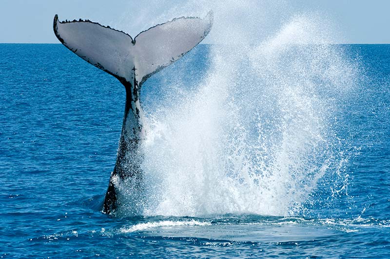
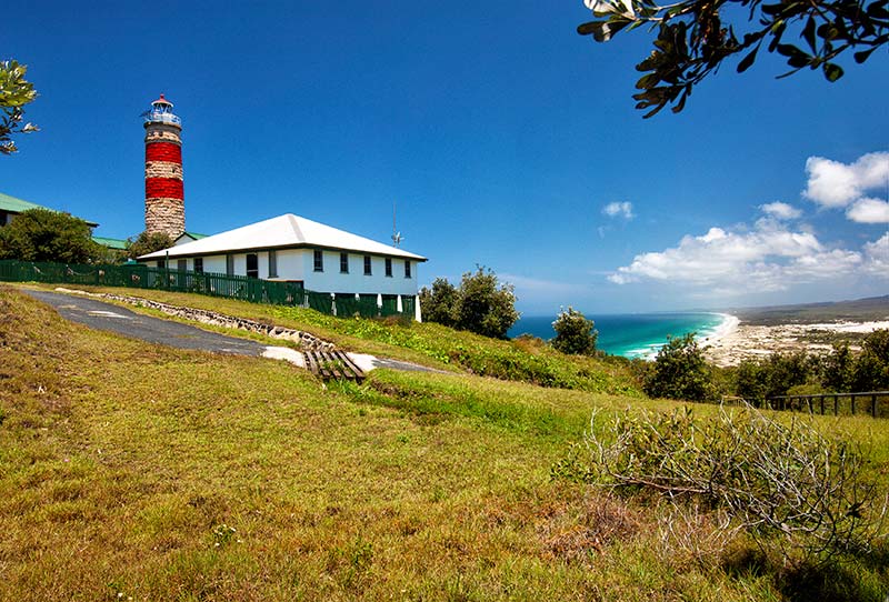
A T-junction leads on the right to Cape Moreton with a fascinating information centre, a 1.5km walking track and a lookout with views from here to eternity. Watch for humpback whales migrating north in June/July, and then south again around mid-September through mid-November.
Turtles and sharks can also be seen in the sea below. There is no access to the Cape Moreton Lighthouse, Queensland’s oldest functioning lighthouse, built in 1857 with convict labour after a number of ships came to grief on the surrounding reefs.
Back at the T-junction, turn right again to North Point. There is no driving east on the beach here, so park your 4WD and get out for a walk to the Champagne Pools and then Honeymoon Bay: gorgeous. A 1km 4WD run west along the beach leads to Bulwer-North Point Road. You can park here for a walk to the Yellow Patch sandblow, and if the tide is low, a walk out to Heath Island Lagoon for some fishing at the north-east entrance.
NORTH POINT TO BULWER
Continuing west on Bulwer-North Point Road for 3.6km. Don’t miss the parking pull-out to the north with a 1km return walking track to the Five Hills Lookout. This has views to Heath Island Lagoon, Yellow Patch and Lake Jabiru. You did remember to bring your camera, didn’t you?
After another 3km, Bulwer-North Point Road connects with Bulwer-Blue Lagoon Road. Here, you can return to the east coast exiting at N6 on the beach and then continuing to Middle Road (or your campsite).
Alternatively, keep heading west for another 1.5km to a T-junction. To the north is Tailor Bite, certainly worth the 2.2km return 4WD track, but do not attempt to drive on the beach here due to the suck-you-up tidal lagoons.
Turning south at the T-junction is the exceptionally loose, boggy 2.6km track to Bulwer. If supplies are running low, this is a good place to stock up (or enjoy a meal) at the Castaways Store. North on Moreton Street is the Comboyuro Campground, to the south is the Bulwer Bypass leading back onto the western beach where you can only head south.
BULWER TO MIDDLE ROAD
About 3km down the beach from Bulwer is the Cowan Cowan Bypass. This track must be used, as beach driving is not permitted. Just offshore is the Curtin Artificial Reef, an underwater wrecking yard of dozens of car bodies, thousands of tyres, concrete pipes, a few barges and a couple of tugboats. The fish and invertebrate life don’t seem to mind the rubble, and this is now considered a good snorkelling or dive spot.
The Cowan Cowan Bypass is 3.5km long, and then there you are on the beach again, right around the Ben-Ewa Campground. Middle Road, the start of our tour, is 0.5km further. You will have seen a dozen places to return to: the lookouts, the campgrounds and camping zones, the fishing, the water activities, the walking tracks and the sheer splendour of this stunning sand island.
One thing is for sure, you will want more of Mulgumpin Island; a single visit could never be enough.
– Images: Steven David Miller / Natural Wanders
ESSENTIAL PLANNING INFORMATION
- Mulgumpin (Moreton Island) National Park
- Park’s Visitor Guide Park’s Maps and Links Park’s Campgrounds
- Moreton Island Adventures & Micat Guide
- Visit Moreton Island
- Moreton Island Discovery Guide.
BEFORE YOU GO
Pick your ideal campground with Mulgumpin Camping. Most campgrounds and bushcamping zones have sites for offroad camper trailers. Check the details for each area. Note that camper trailers should only be towed on Bulwer-Blue Lagoon Road or Bulwer-North Point Road; Middle Road is unsuitable for towing.
Book your campsite online through Mulgumpin Camping or by phone (07) 3506 2371. Also look through the camping guidelines.
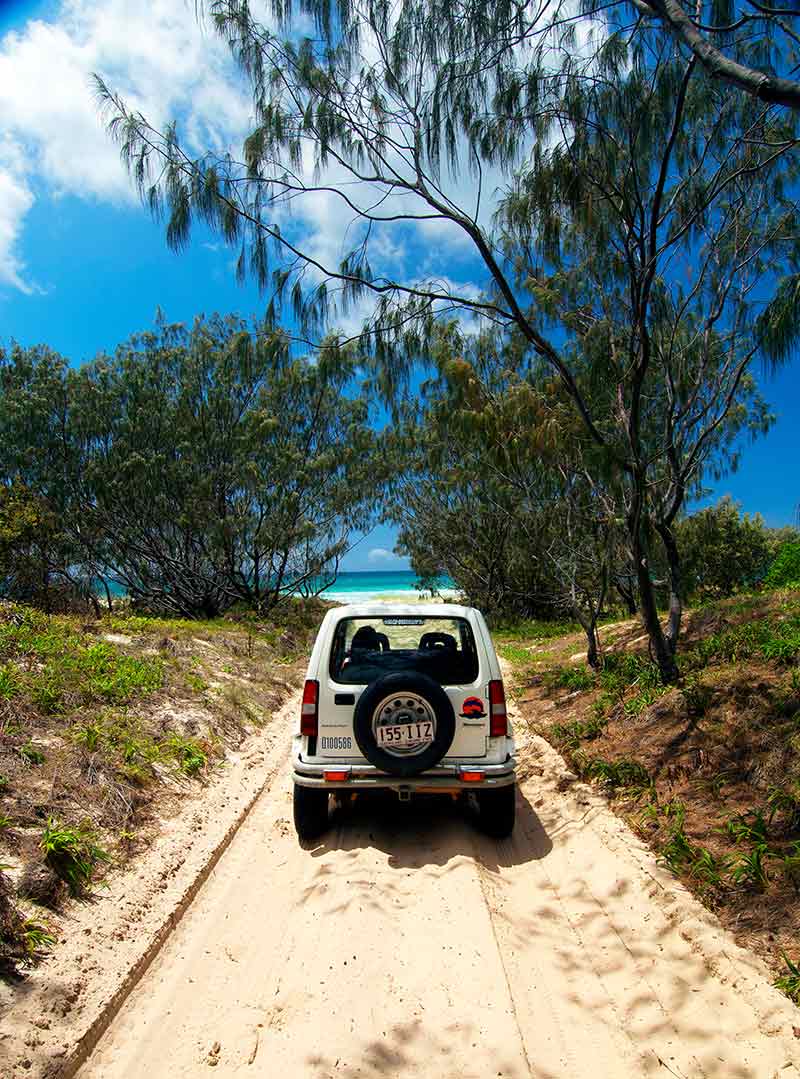
The island is only accessible by 4WD and vehicle permits are required in advance through Mulgumpin Camping.
If you are not experienced driving on sand, study the Driving on Sand guide. Also study the Staying Safe information.
You have to juggle your camp booking with your Micat ferry booking through Moreton Island Adventures. It is located at, and departs from, 14 Howard Smith Drive, Port of Brisbane. Phone (07) 3909 3333.
WHAT TO TAKE
BYO everything (especially drinking water), firewood, fuel stove, rubbish bags and plenty of food. Bring a well-stocked first aid kit, water purifying tablets and insect repellent. Fill your 4WD to the brim with fuel before leaving the mainland.
Limited supplies are available at Bulwer and at Tangalooma Resort; fuel is usually available at the Bulwer Store in 20L drums.
Snorkelling gear, fishing gear, body board, hiking boots, binoculars, camera. Snorkelling gear and kayaks can be rented from Sunset Safaris on the beach (near Tangalooma Resort).
Travel is by 4WD only; your vehicle should have high clearance and low range, sand recovery gear, an air-compressor and a shovel. Mulgumpin provides the perfect excuse to get that set of MaxTrax you’ve been thinking about.
WARNINGS
The west coast between Tangalooma and Kooringal has mangrove areas with quicksand in the tidal flats.
The speed limit on the beach is 60km/h, dropping to 20km/h in some zones.
Mobile phone reception is random to non-existent. In an emergency, try 112.
Rubbish bins are provided at the Wrecks and Comboyuro Point campgrounds only; take all other rubbish with you.
Untreated bore water is available at Eagers Creek (N2), Rous Battery (near S11) and Big Sandhills (12km south of Tangalooma).
Do Mulgumpin Island a favour: BYO a portable toilet for bushcamping in the zones and take the contents with you off the island.
Check the Moreton Island Conditions Report before arriving.
RECOMMENDATIONS
Since the Micat ferry isn’t cheap, try to make this at least a four-day trip.
Plan beach-driving two hours either side of a low tide. Check tide times for Brisbane Bar or download a tide table. Mulgumpin’s east coast is 90 minutes earlier than the Brisbane Bar high/low tide and the west coast is up to 40 minutes earlier.
You can combine your trip to Mulgumpin with a visit to North Stradbroke Island (Minjerribah). Leave Mulgumpin Island from Kooringal, accessing this via the east coast beach south of Middle Road. Take the Kooringal Trader barge to Amity on North Stradbroke Island to enjoy this enchanting island. For information, visit Stradbroke Island. For the vehicle barge, visit Stradbroke Ferries. For a story about Straddie check www.GoRV.com.au. You can return to the mainland from Straddie.


